

Alphington Link
We’re connecting bike riders and pedestrians in Alphington to the Darebin Creek Trail with a new off-road walking and bike riding path – the Alphington Link.
Underway
Update – September 2026
Works continue on the delivery of the new Alphington Link, a safe and direct walking and bike riding connection for the Alphington community.
The new 120m shared use path, incorporating a new raised crossing on Farm Road, will enable bike riders and walker to safely connect to the Darebin Creek Trail from Farm Road.
Since works began in April, we have:
- undertaken earthworks to make way for the new shared use path
- completed boring and piling and installed retaining wall posts and panels on the upper side of the shared use path
- commenced drainage works.
Over the coming month, our crews will:
- complete drainage works
- construct the retaining wall on lower side of the shared use path
- lay a new pavement for the path
- install protective fencing and rails for walkers and bike riders
- apply linemarking and install signage
- undertake landscaping works
- install the new raised crossing and lighting on Farm Road.
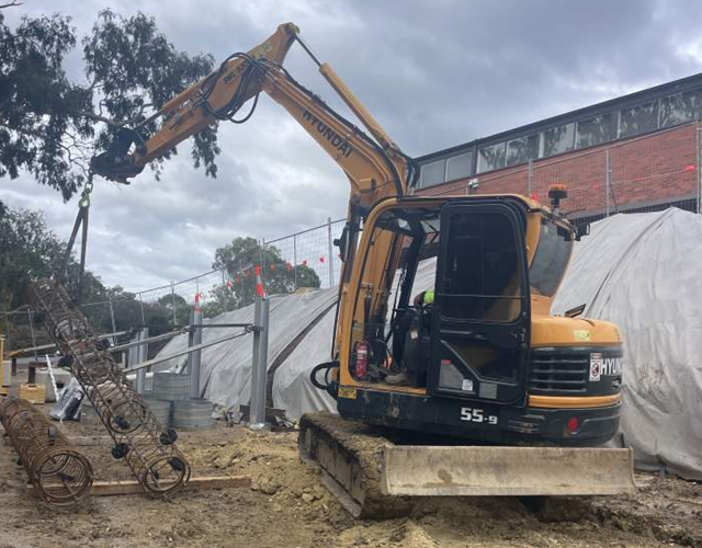
Image: Retaining wall piles and posts being installed
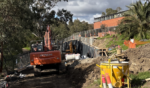
Image: Construction continues on the upper retaining wall
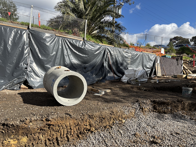
Image: Subsurface drainage pit being prepared for installation
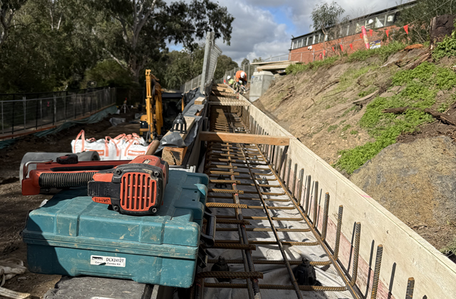
Image: Formwork for concrete drain on top of retaining wall
What to expect during works
- Works will continue on weekdays between 7am and 6pm.
- NOTE: dates and times are subject to change due to weather conditions and the contractor’s program of works.
- Most construction works are off-road, however there will be some traffic disruption on Farm Road when crews install the raised crossing.
- There will be medium to high noise levels during retaining wall and asphalt works. Low to medium noise during all other works. For the safety of road users and workers, reversing beepers are required on all machinery.
- Golfers wishing to use the practice fairway will continue to be temporarily detoured via the Darebin Creek Trail.
- Up to four parking spaces on Farm Road will be permanently removed to make way for the new raised crossing.
Background
In 2018, we commenced community engagement on the project to inform the technical development of plans, designs and options.
In 2021 we passed a necessary legislative amendment to enable compulsory acquisition of the land for the path. Wider community consultation took place on the proposed designs between 8 December 2021 and 31 January 2022.
Feedback from this consultation helped us develop a design to ensure the Alphington Link reflects the community’s needs. Specifically, community feedback favoured a design that is sensitive to the environment, blends into the landscape and minimises construction impacts.
As a result, the decision was made to build a walking and bike riding path at ground level instead of an elevated bridge, would save trees and have less impact on the landscape.
The ground level path will blend better into the local environment, and the construction will be faster, reducing impact on residents and the golf club.
The path design
The new 3.0-metre-wide walking and bike riding path follows the same route as the earlier bridge design concept, from Farm Road to the Darebin Creek Trail through the Latrobe Golf Club.
Bike riders and pedestrians will be protected by fencing, and golfers who want to use the practice greens/fairways will still have access.\
The design includes landscaping that is sensitive to the local area and blends with the surrounding environment.
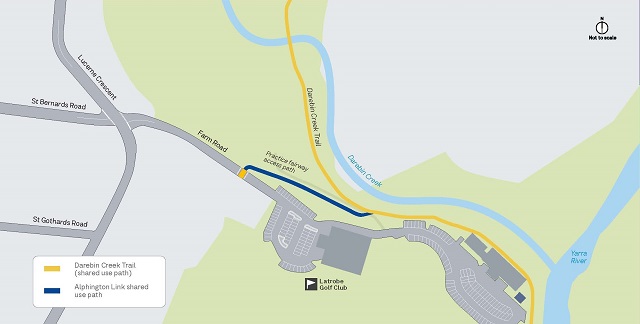
Alignment of the new path follows the same route as the previous design
Designs
See below artist impressions of the Alphington Link. Please note, these designs are subject to change.
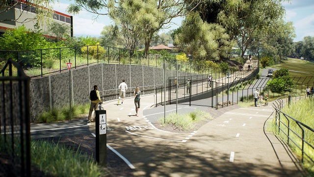
Looking toward the new Alphington Link from the Darebin Creek Trail. Artist impression, subject to change.
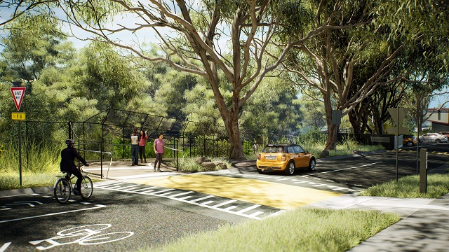
Looking toward the new Alphington Link entry from Farm Road. Artist impression, subject to change.
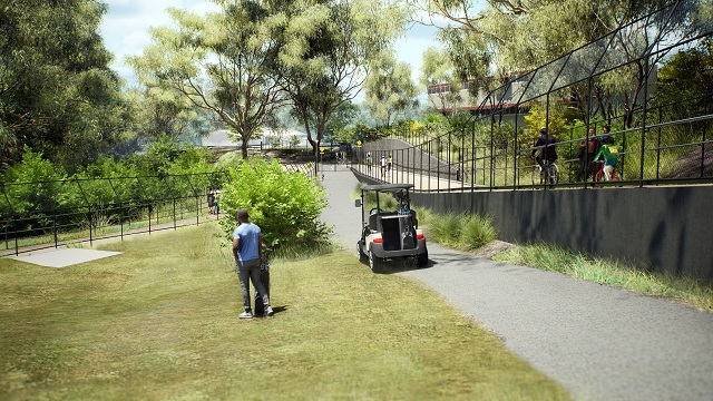
Looking toward the new Alphington Link from the golf course practice fairway. Artist impression, subject to change.
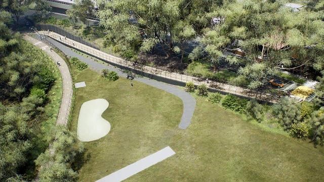
Aerial view of the new Alphington Link from above the golf course practice fairway. Artist impression, subject to change.
Planning approvals
The Minister for Planning approved Planning Scheme Amendment C329yara to the Yarra Planning Scheme on 22 December 2025, which enables the delivery of the Alphington Link project under the Alphington Link Incorporated Document (DTP, 2025).
A copy of the Amendment can be inspected, free of charge, at the Department of Transport and Planning website or by contacting 1800 789 386 to arrange a time to view the Amendment.
The following documents have been approved under the Alphington Link Incorporated Document:
- Environmental Management Framework (4.2.1) (PDF)
- Landscape Plan (4.2.10 & 4.2.11) (PDF)
- Urban Design Statement (4.2.12) (PDF)
- Public Lighting Plan (4.2.13) (PDF)
- Tree Management Plan (Clause 4.2.14) (PDF)
Benefits of the Alphington Link
The Alphington Link will provide the local community with a safer and more direct route to the Darebin Creek Trail and 600km of bike riding and walking routes.
Improving walking and bike riding connections that enable more Victorians to walk or get on their bike for everyday trips, supports the climate change pledge of 25% active transport mode share by 2030.
Walking and bike riding paths benefit a broad demographic, including families, schoolchildren, older people, and people with disabilities.